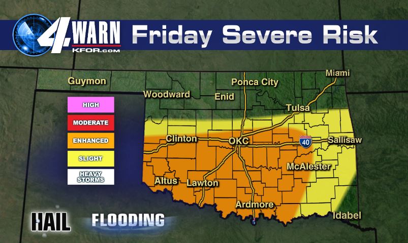
Severe thunderstorms have formed early Friday afternoon and will continue through the evening hours. Most of the threat will be confined to areas south of I40. With plenty of instability, very large to giant hail will be possible with the strongest storms.

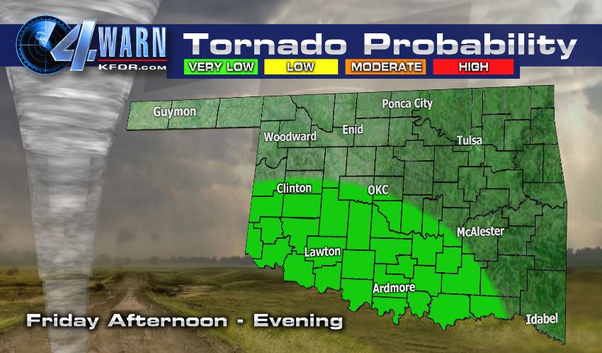
A secondary, but serious threat will be flooding as we will see several inches of rain in just a couple hours’ time. Remember, turn around, don’t drown! Thankfully, the tornado threat is very low today.
After 9-11PM, storms will fizzle out and things will calm down across the state. Look for lows in the low 60s overnight.
An isolated shower is possible tomorrow, but severe weather is not expected.
Look for nearly a week’s worth of dry weather starting this weekend!
-Meteorologist Aaron Brackett