If you have access to the internet, social media or that one coworker that loves to small-talk, you have heard about the chance for winter weather this week in Oklahoma.
Before you start clearing out grocery stores and shouting “SNOW THIS” and “ICE THAT” I’ll give you a meteorological “behind the scenes” of why winter weather forecasting is so difficult.
With all forecasts, meteorologist rely heavily on computer models. We also incorporate our own pattern recognition and past experience to “fill in the gaps.”
Check out the difference in these two computer models. The first one was from Monday, and the second one is from today (Tuesday).
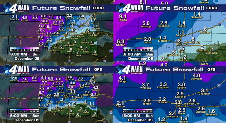
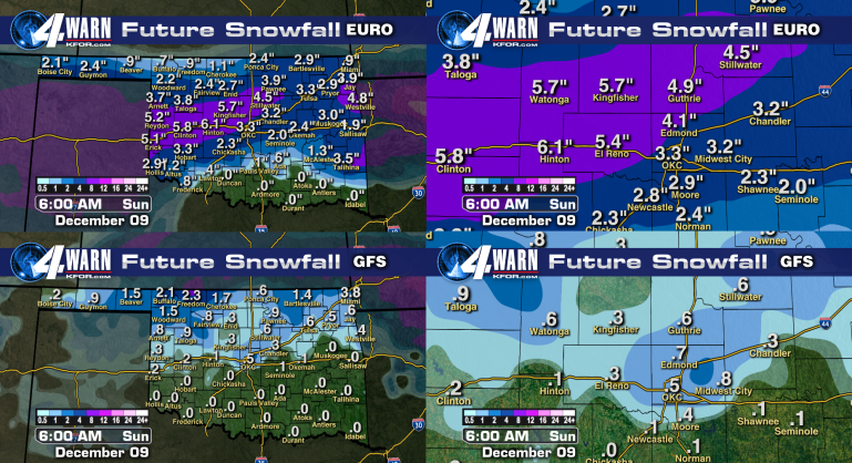
As you can see the models have changed drastically (and even flipped on the totals for OKC). If you live in Buffalo, yesterday it looked like you would see 6″+ of snow, but today the computer model average is less that 1.5″.
Unfortunately for meteorologists, more isn’t necessarily better. Here is a picture of the forecasted ice totals for the state from 3 separate computer models.
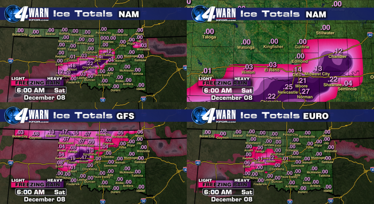
This frustrates meteorologists because everyone will share an Armageddon snowfall picture, and if you only get a trace we get blamed for over-hyping and “I wish I could keep my job if I was wrong 50% of the time.”
When it comes to forecasting 4+ days from a significant weather event, meteorologist tend to look at jet stream patterns. The jet stream is what pulls Arctic air in from the north, and Gulf moisture in from the south. This, coupled with a decent snow-pack in the northern plains suggests a favorable environment for winter weather.
The reason winter weather is so difficult to forecast is “warm” (above 32°) layers in the atmosphere. The sky is like a cake. there are layers on top of layers on top of layers. If there is even a shallow “warm” layer, that makes all the difference between rain, freezing rain, sleet and snow.
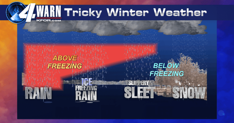
Most precipitation falls as snow. If the entire sky is below freezing it remains snow all the way to the ground and you start conjuring thoughts of Bing Crosby (if you’re anything like me).
If most of the atmosphere is above freezing then the initial snow will melt into rain and remain rain all the way to the surface… and disappoint snow lovers everywhere.
Where it gets tricky is when there is a shallow “warm” layer close to the surface. The depth and location of the “warm” layer is what determines if we see sleet or freezing rain.
Computer models have a difficult time differentiating if/where that “warm” layer will be, especially days out from an event. As you saw earlier, they can be wildly inconsistent from model run to model run.
With inconsistent and inaccurate weather models, we have to rely more on our experience to make an accurate forecast. The “I WANT IT NOW” mentality of social media is very impatient with breaking weather forecasts. With dangerous conditions possible it’s understandable, especially if you have to make alternate plans if schools close.
Here is a breakdown of my confidence in this week’s winter weather forecast:
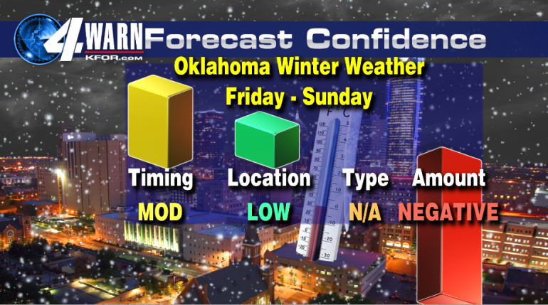
Forecasting winter weather this far out is like putting together a 5,000 piece puzzle blindfolded.
Here’s my outlook:
I am generally confident about the timing (early Friday into early Sunday)I am NOT confident about the location of the ice/snow. Right now it looks like anything north of I-44 is fair game for something (freezing rain, ice, snow, locusts, etc.).
I have no faith in the computer models ability right now to differentiate between freezing rain, ice or snow. Maybe locusts though..
Having said all of that, I have NEGATIVE confidence in the amount of winter weather you will see.
I’ve lived in central Oklahoma my whole life (except for the 5 years I was in the Marines) and I will say that Oklahoma does not get enough attention when it comes to how many ice storms we see. Stay tuned for further updates.


