
High pressure and a ridge will be here for several days, however a more typical Spring pattern will return late week into next weekend…
Saturday night will be dry. Clouds will start to filter out from west to east, mainly after midnight. Look for mild lows in the lower 60s. A few areas of patchy fog may be found late.
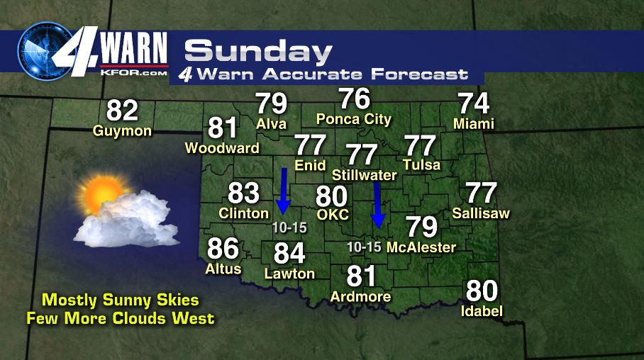
Look for gorgeous weather Sunday through the beginning of the work week. Each day will feature mostly sunny skies and nice temps in the upper 70s to low 80s!
The weather pattern will begin to change by week’s end. An area of low pressure and associated trough will set up to our west, bringing a route and ingredients for severe storm chances to resume Friday through the following week. Stay tuned as we get closer!
-Meteorologist Aaron Brackett